An epic challenge walk that rivals the Yorkshire Three Peaks in scale, the unique scenery, gruelling ascents and quietness of these fells make for a fantastic day out.
Distance: 35km (22 miles)
Ascent rating: Intense
Highest point: The Calf, 676m
Difficulty and hazards: decent paths along the first part of the walk. Return leg requires off-path navigation after Randygill Top. Steep ascents throughout - Yarlside is particularly tough and will be very difficult in poor weather. Stream crossing required after descending Yarlside - again should be fine in good weather, but risk could increase after heavy rain.
Parking: Paid Parking available in Sedbergh.
Refreshments: Pubs and restuarants in Sebergh at the start and finish, but nothing on the way around. Pack enough supplies for the whole trip
Accommodation: Several accommodation options available in Sedbergh. Some Airbnb options in the Lune Valley, halfway around (in case you want to start the circular at the northeern end)
Allow: 8 hours
Map Coverage: OS Explorer OL19 (get it here)
Every time I’ve travelled up the M6 to visit the northern Lake District, I’m always mesmorised by the towering fells that the road snakes through as it winds up towards Tebay. More hill-like than much of the Lake District, but more mountain-like than much of the Yorkshire Dales, the steeply-sloped peaks seem far less busy and far more remote that the honeypots of the Lakes, despite the M6 thundering through.
For anyone who doesn’t know, these are the Howgills. They’d been on my to-do list for a while, and with much of the southern Yorkshire Dales now explored, I finally gave into temptation, got myself the OL19 map, and planned a visit.
The main problem with the Howgills for me had been that they were a long way away. To travel this far into the Yorkshire Dales, as epic as the Howgills appeared, I may as well go the small distance further and enter the Lake District. But this is perhaps doing the Howgills a huge disservice - the landscape with the steep inclines is quite unlike anything I’ve visited before, and the views from the various summits, despite only a few of them qualifying as mountains, are as breathtaking as anything in the Dales, aided by the fact that the Lake District Fells are now REALLY close.
Not one to do things by half, I was intrigued by the concept of a big circular route of the Howgills in a day. There are a few options to do this (due to the fact there are so many deep-cut valleys running north-south through the Howgills, there are always going to be summits you need to miss out), but I settled on a route starting in the Dales town of Sedbergh (Sed-buh for the un-initiated) that would take on all the major summits, including three out of the four trig points: Winder, The Calf and Green Bell.
Sedburgh is a lovely little town that sits at the Southern tip of the hills, It’s probably worth a little wander around the town before you set off and taking the time to stock up on supplies - once you set off on this walk, there are no options to replenish. Parking is availale in the market square - obviously check whether the market is on first! I arrived on a dry but slightly overcast day, and the town was quiet.
Leaving the car park, I turned right and headed north. Following the street uphill, it soon bends to the right. What starts as a residential street soon becomes sparse as I headed along, before I found myself in one of those ‘is this the path or someone’s drive’ moments as I approached a small farm (the answer to that question, as it often is, was ‘both’).
Following the path past the farm, it soon beared to the left, before reaching the first stile.
Here, my planned route was to take a sharp left, and cross a right of way over the fields, skirting the bottom of the first of the Howgills, Winder. The route followed a small track before heading out into open fields (thankfully filled with sheep rather than cows), and I simply navigated between the stiles. Sedbergh was now below me to the left, snuggled cosily in the valley below, and cars followed the snaking roads into the various valleys that spread out from its centre.
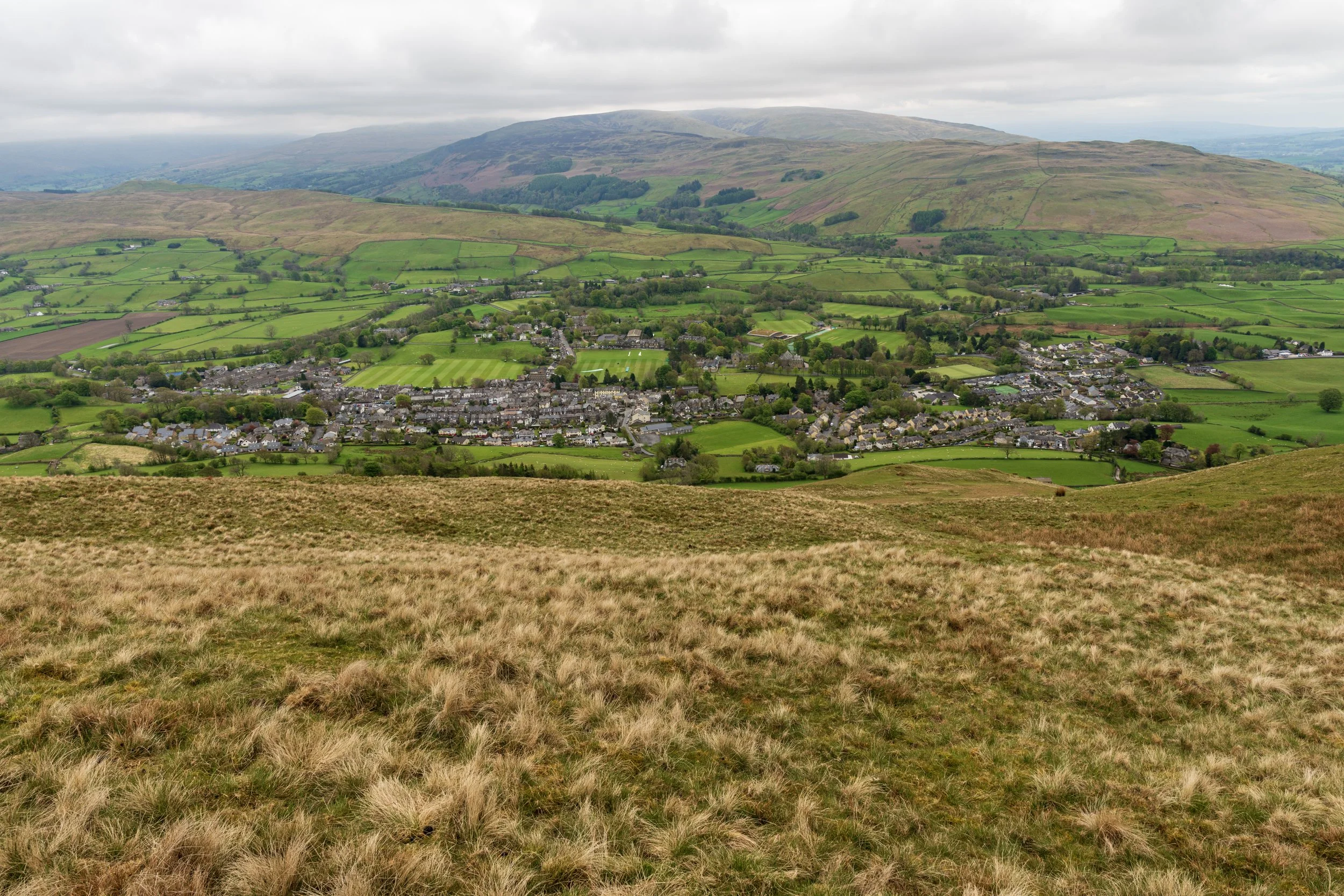
Before long, the right of way led me to the second ‘is it someone’s drive or is it the route?’ moments (again, the answer was both), though a helpful, if slightly intimidating sign warned me where the path was. I looped through the farm, and was relieved to find myself on a small road. Turning right, the road soon terminated at a stile, and I crossed it to find myself in open access land at the foot of Winder, the first peak of the day.
Ignoring the path that skirts the wall of the open access land, I took another path leading up the fell, slightly to the left. The path faded in and out of existence, but climbed steeply, soon joining a more substantial track. I continued to follow the path as it climbed for about 1km. The climb had been relentless since leaving the farm, with Winder making me work hard to scale its (on paper) relatively low height.
It soon became clear that the summit was up the steep bank to my left, with the path I was on seeingly skirting around it. After checking the map, I realised my best bet was to leave the path and scale the hill.
The climb was tough, and I occasionlly stopped to take in the view of the ever-shrinking Sedbergh below. The views now extended along the valley and into Garsdale, with the upper western fells of the Dales now visible. To the west, I could now see the M6 in the distance. Finally, the slope levellde out, and the first trig point of the day appeared at the summit of Winder.
The view from Winder was spectacular, and I was impressed by just how few people I’d seen so far. Little did I know at this point that the experience was to serve as a taster for the rest of the day.
Whernside had emerged from behind the fells surrounding Sebdbergh, and to the east, the unmistakable shape of Wild Boar Fell dominanted the horizon. Beyond the M6, the first of the eastern Lake District fells were visible, but the rest were shrouded in low cloud.
To the north, was real wild country. A path led into the rolling Howgills, snaking up the neighbouring summits.
I set out along the path, descending slightly, onto a broad ridge. The ground dropped away sharply on both sides, forbiddingly steeply, and a stream could be seen winding its way out of the deep valley to my left. The fell immediately in front of me now, Arant Haw, curved around to the left, with steep, scree sides dropping into the chasm below. It was truly epic.
Arrant Haw lies at 605m, and much like Winder, had no path marked on the map, leading to its summit. On the ground however a track had been worn away, and I took this track, forking left from the main path, heading up another slope.
Though less steep than my inital climb up Winder, Arrant Haw still remained a tough ascent. Taking a few breathers on the way up to take in the ever-expanding view, I reached the summit to be greeted by the next challenge of Calders, which had appeared on the horizon.
The drops down the side of Arrant Haw into the abyss were heady, and certainly discouraged me from dropping down from the tops. The path itself dropped down to another col, before what looked like another steep climb to Calders, its pinnacle towering above everything around it.
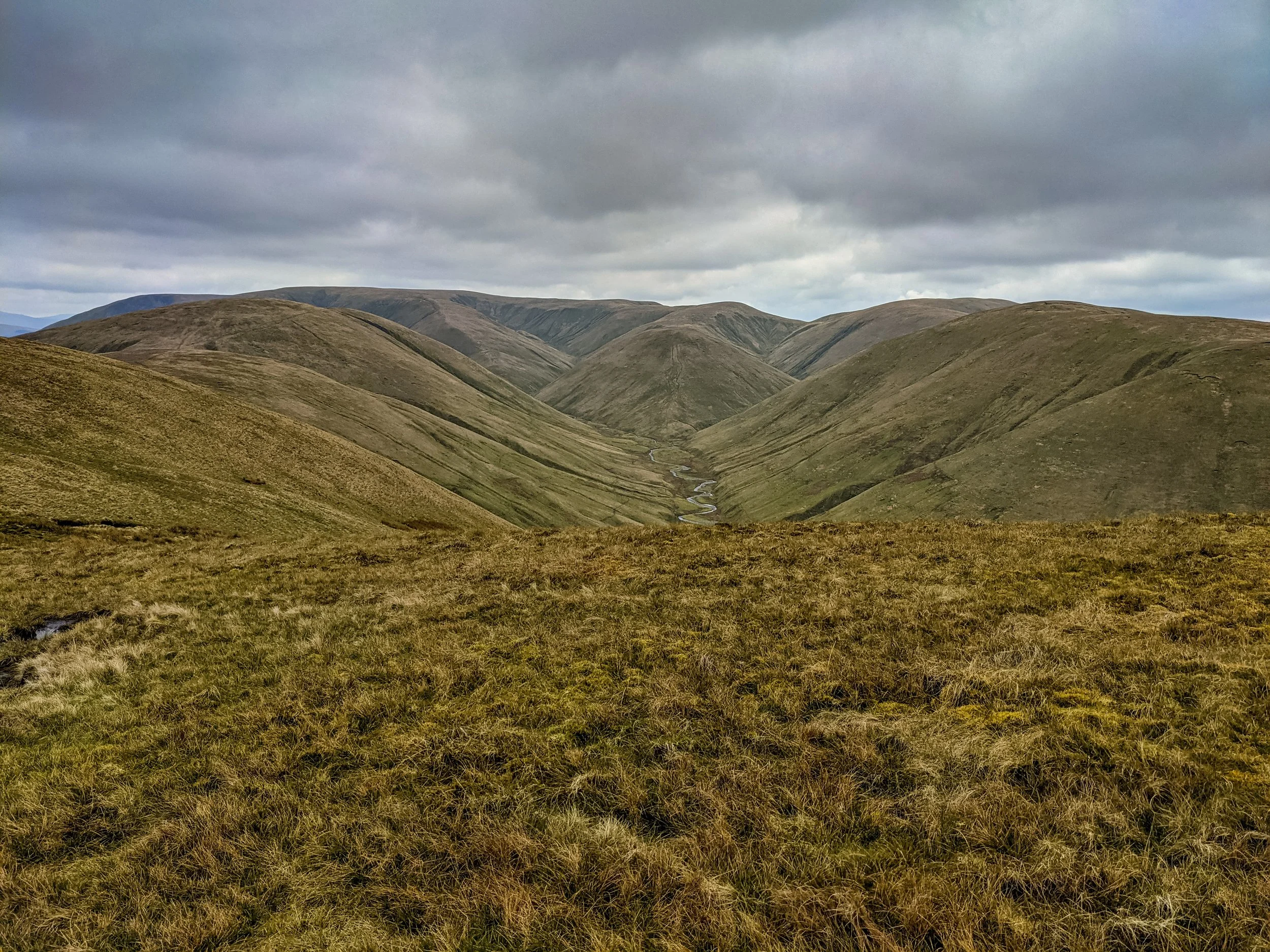
I set off down the path, and as I dropped, Calders looked more and more imposing. I took a moment on the ridge to cross the fence and get a stunning view of the valley carved by Hobdale Beck, leading out of the Howgills and into the northern Yorkshire Dales.
I braced myself and started to tackle Calders. The path wound up to the left, before snaking around to the summit. The final steps had a slightly exposed feel - never truly precarious, but allowing the views to open on all sides.
The view from Calders spread out to the west, east and south, with a plateau to the north. This was my route - fowlloing the path across to reach the highest point of the walk - The Calf.
On the way to The Calf, I left the path to find the spot height on the neighbouring Bram Rigg Top - ultimately there was nothing to see other than shallow bog and grass, but it was worth ticking it off the list. The Calf now lay before me - the ground sloped down slightly before a small ascent to the summit. I cut across the land to meet the path at shoulder between The Calf and Bram Rigg Top, before tackling the small climb to the summit.
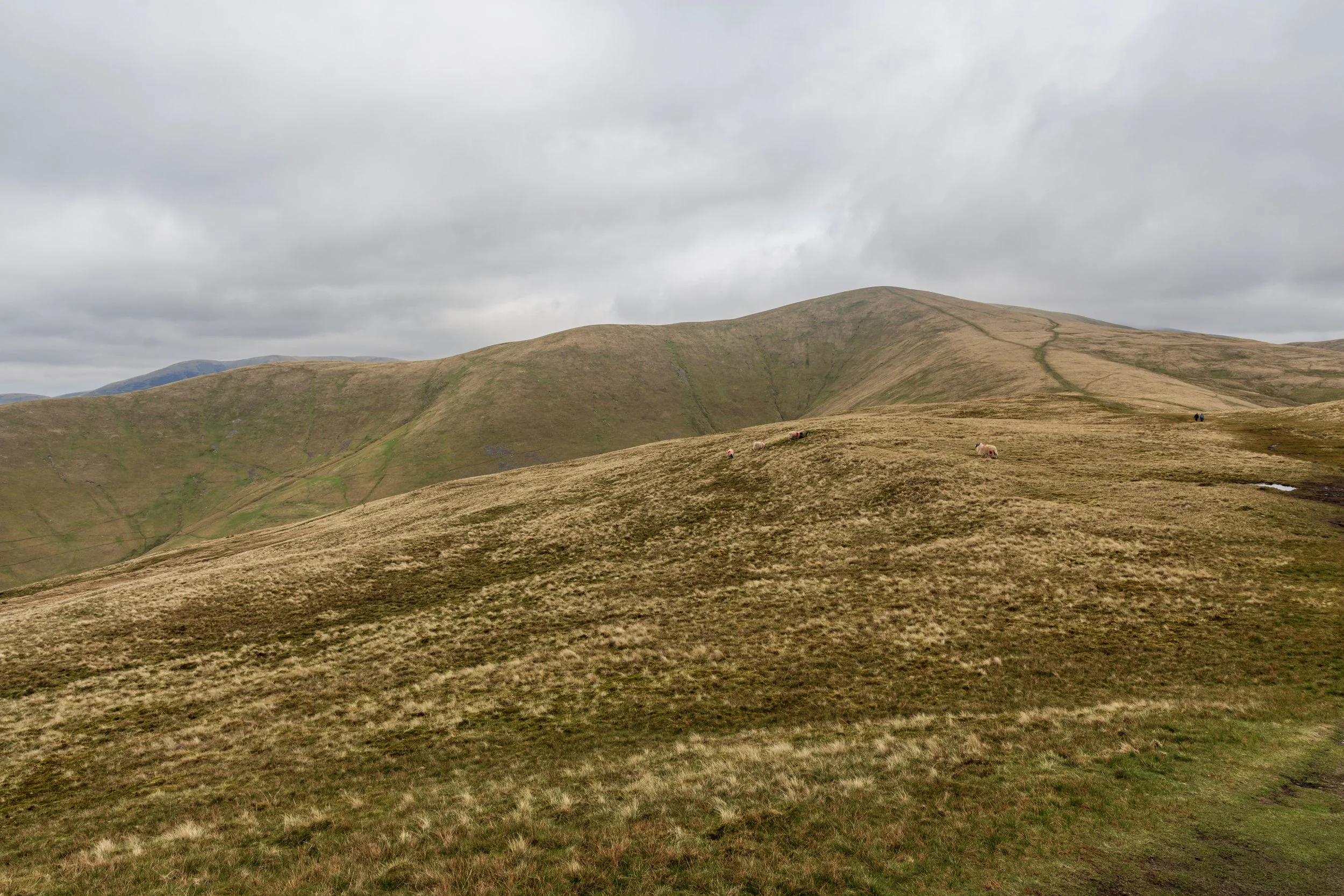
From the top of The Calf, the northern Howgills were now visible - a collection of undulating slopes spreading out as far as the eye could see. The summit of The Calf was also the meeting point for other paths leading to the east and west, and for the first time, I felt like I’d rejoined civilisation, as a number of people approached from all directions to reach their summit for the day.
I took in the view for a moment, broke out the snacks, before taking the path to the north east. I followed this as far as a small tarn. I was aware that I needed to head north at the tarn. The path was less than obvious, and missing it would have meant descending deep into Bowerdale. The last thing I wanted to do right now was lose the height!
I found the path, identifiable more by discolouring of the grass than anything else, and followed it along. I could see the Calf now, behind me and to my left, with a slope dropping off steeply to my left. The path ahead seemed to roll on for miles, undulating along the ridge. I broke out some lunch on the move, and marched on.
The next summit was Hazelgill Knot, standing at 578m. The path had been steadily descending since the tarn, and a small incline now greeted me. The peaky hills surrounded me on both sides, and I tried to work out the ones to the east, as I suspected these would be the hills I’d be returning on. Bowerdale spread into the distance below me, with Yarlside dominating the skyline. Hazelgill Knot approached, a slight incline to a largely featureless plateau, which then desceded steeply, before rising again to a further unnamed peak. Over the next 3km, the path continued its gentle descent along the ridge. At one point I passed a couple walking their dog, and it struck me that these were the first people I’d met since leaving The Calf.
The Lune Valley now stretched before me, marking the northern end of the Howgils, with the cullinary delights of Tebay Services appearing tantilisingly close, though practically still far out of reach. I followed the path along a wall for some distance, before it finally headed off to the right to make its final descent into the valley. Before I knew it, I was standing on a road. I’d just completed my crossing of the Howgills.
I turned right along the road, and followed it towards the busy A685 in the distance. Some workmen nodded a ‘hello’ as I passed, but the route was otherwise deserted and peaceful, save for the road traffic in the distance. Just before reaching the A685, I crossed a stile onto a right of way through some farm fields, heading away from the road again.
Navigating through farm fields can sometimes be tricky - the pressure of finding the quickest public route through isn’t made an easier when the stiles are hidden, and the paths haven’t been trodden very well. This particular route looked seldom used, but a welcome feature was that the tops of the stiles had been painted yellow, making the route easily visible. This small gesture is a brilliant solution for all involved - the last thing most walkers want to do is wander off a right of way into private land, and this helps the landowner by ensuring hikers pass through as efficiently as possible. After passing a farm, the path briefly crossed a common, before entering a wood. This turned out to be a tree nursery, and a delightful path took me through the grounds, emerging on a road near the entrance.
I followed the quiet road for a little, as the wall fell away to my right and the ground opened up. A number of paths led up onto the moors, and I took one of these, knowing it would soon join a track. I was ascending again now, leaving the valley behind and re-entering the Howgills.
The path wound up the hill and my surroundings suddenly started to become sculpted hills again. I passed High Knott, a peak to my right, and my next target of Green Bell rose before me.
At 605m, Green Bell doesn’t quite qualify as a mountain, but is one of only three trig points in the Howgills. Unlike the trig point on The Calf, Green Bell was deserted, and the weathered, stone monument was a lot less cared for. Still, the views were fantastic, now peering south into the heart of the Howgills once again. In front of me lay a path descending along an inviting, broad ridge, and then ascending back towards Randygill Top, a higher summit (and this time, technically a mountain).
Here, the track I had been following seemed to melt away. I could see my next peak of Kensgriff in front of me, but with no path, I trundled down the steep slopes of Randygill Top, before coming across a small track that took me up again to the summit of Kensgriff. My legs were now feeling the punishing ascents and descents, but I slowly reached the top. By this point I had expected to be numbed to the fantastic views on each peak, but they still continued to amaze. Here though, the track led down the hill to the south and the imposing next peak of Yarlside rose steeply up beyond the col. As I descended, the true scale of the next challenge became clear. There really was no obvious route up the hill. The slopes to the left were high, exposed and craggy - they certainly looked like I could get into trouble on there very quickly. The map suggested that a 2km detour to the right may be a good option to allow me to ascend the hill on its shoulder, but with my legs flagging, I did not fancy the extra distance. The final option was a steep, grassy scramble up the side of the hill. This was going to hurt.
I embakred on the scramble, not daring to look down. The route was barely manageable - over 100m of climbing at over a 45 degree angle. The second half was a touch easier than the first, and eventually after much huffing and puffing, I pulled myself over the edge, and saw the reward of the summit in the distance.
A small cairn stood on top of the summit. Catching my breath, I say the Yorkshire Three Peaks to the south. The sense of achievement rode over me, and soon I was starting to work out where to go next. The descent was perhaps only slightly easier than the ascent - slightly less steep, but punishing on my knees. I reached Bowerdale Beck below, over 200m lower than Yarlside. I had intended to visit Cautley Spout - the highest above-ground cascading waterfall in England, but with my legs ready to collapse under me, I sought a more forgiving route. The bad news: The most direct route back to Sedbergh required climbing The Calf again. The only alternative added an extra 7km onto the journey.
I limped up the path, slowly up to the summit of The Calf. It probably took me about 40 minutes to cover 1.5km, stopping every few hundred metres, but eventually I reached the tarn I had visited earlier. I decided to forego the trip to the summit (saving myself 6 metres of climbing!) and headed straight for Calders.
Luckily, from here it was downhill all the way, and I pretty much rolled down the hill. I forked off between Arant Haw and Winder (taking in neither summit) and followed the more direct Dales High Way down towards Sedbergh as evening fell.